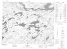
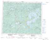
Maps showing Rivière Causabiscau, Baie-James; Jamésie, Quebec
Rivière Causabiscau is a River located in Baie-James; Jamésie, Quebec and has an elevation of 221 meters.
- Latitude: 52° 12' 6'' North (decimal: 52.2017706)
- Longitude: 76° 47' 21'' West (decimal: -76.7891759)
- Topography Feature Category: River
- Geographical Feature: Rivière
- Canadian Province/Territory: Quebec
- Elevation: 221 meters
- Location: Baie-James; Jamésie
- Atlas of Canada Locator Map: Rivière Causabiscau
- GPS Coordinate Locator Map: Rivière Causabiscau Lat/Long
Rivière Causabiscau NTS Map Sheets