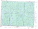
Maps showing Lac Cedar, Rivière-Kipawa; Témiscamingue, Quebec
Lac Cedar is a Lake located in Rivière-Kipawa; Témiscamingue, Quebec.
- Latitude: 47° 7' 48'' North (decimal: 47.13)
- Longitude: 77° 51' 53'' West (decimal: -77.8647222)
- Topography Feature Category: Lake
- Geographical Feature: Lac
- Canadian Province/Territory: Quebec
- Location: Rivière-Kipawa; Témiscamingue
- GPS Coordinate Locator Map: Lac Cedar Lat/Long
Lac Cedar NTS Map Sheets