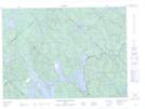
Maps showing Rapides Cedar, Baie-de-la-Bouteille; Matawinie, Quebec
Rapides Cedar is a Rapids located in Baie-de-la-Bouteille; Matawinie, Quebec and has an elevation of 381 meters.
- Latitude: 46° 51' 31'' North (decimal: 46.8586483)
- Longitude: 73° 37' 19'' West (decimal: -73.6220828)
- Topography Feature Category: Rapids
- Geographical Feature: Rapide
- Canadian Province/Territory: Quebec
- Elevation: 381 meters
- Location: Baie-de-la-Bouteille; Matawinie
- Atlas of Canada Locator Map: Rapides Cedar
- GPS Coordinate Locator Map: Rapides Cedar Lat/Long
Rapides Cedar NTS Map Sheets