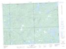
Maps showing Rapides Cedar, Rouyn-Noranda; Rouyn-Noranda, Quebec
Rapides Cedar is a Rapids located in Rouyn-Noranda; Rouyn-Noranda, Quebec.
- Latitude: 47° 52' 13'' North (decimal: 47.8702778)
- Longitude: 78° 27' 28'' West (decimal: -78.4577778)
- Topography Feature Category: Rapids
- Geographical Feature: Rapides
- Canadian Province/Territory: Quebec
- Location: Rouyn-Noranda; Rouyn-Noranda
- GPS Coordinate Locator Map: Rapides Cedar Lat/Long
Rapides Cedar NTS Map Sheets