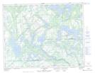
Maps showing Lac Charest, Petit-Mécatina; Minganie, Quebec
Lac Charest is a Lake located in Petit-Mécatina; Minganie, Quebec and has an elevation of 57 meters.
- Latitude: 50° 21' 50'' North (decimal: 50.3639586)
- Longitude: 61° 23' 8'' West (decimal: -61.3856296)
- Topography Feature Category: Lake
- Geographical Feature: Lac
- Canadian Province/Territory: Quebec
- Elevation: 57 meters
- Location: Petit-Mécatina; Minganie
- Atlas of Canada Locator Map: Lac Charest
- GPS Coordinate Locator Map: Lac Charest Lat/Long
Lac Charest NTS Map Sheets