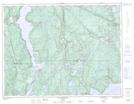
Maps showing Ruisseau Chasseur, Franquelin; Manicouagan, Quebec
Ruisseau Chasseur is a River located in Franquelin; Manicouagan, Quebec and has an elevation of 287 meters.
- Latitude: 49° 26' 26'' North (decimal: 49.4406031)
- Longitude: 68° 0' 44'' West (decimal: -68.0122413)
- Topography Feature Category: River
- Geographical Feature: Ruisseau
- Canadian Province/Territory: Quebec
- Elevation: 287 meters
- Location: Franquelin; Manicouagan
- Atlas of Canada Locator Map: Ruisseau Chasseur
- GPS Coordinate Locator Map: Ruisseau Chasseur Lat/Long
Ruisseau Chasseur NTS Map Sheets