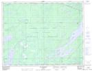
Maps showing Rivière Chébistuane, Baie-James; Jamésie, Quebec
Rivière Chébistuane is a River located in Baie-James; Jamésie, Quebec and has an elevation of 391 meters.
- Latitude: 50° 6' 22'' North (decimal: 50.1061111)
- Longitude: 74° 21' 19'' West (decimal: -74.3552778)
- Topography Feature Category: River
- Geographical Feature: Rivière
- Canadian Province/Territory: Quebec
- Elevation: 391 meters
- Location: Baie-James; Jamésie
- Atlas of Canada Locator Map: Rivière Chébistuane
- GPS Coordinate Locator Map: Rivière Chébistuane Lat/Long
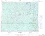
Rivière Chébistuane NTS Map Sheets