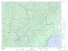
Maps showing Ruisseau chez Tremblay, Ragueneau; Manicouagan, Quebec
Ruisseau chez Tremblay is a River located in Ragueneau; Manicouagan, Quebec and has an elevation of 45 meters.
- Latitude: 49° 4' 1'' North (decimal: 49.0669878)
- Longitude: 68° 32' 19'' West (decimal: -68.5386491)
- Topography Feature Category: River
- Geographical Feature: Ruisseau
- Canadian Province/Territory: Quebec
- Elevation: 45 meters
- Location: Ragueneau; Manicouagan
- Atlas of Canada Locator Map: Ruisseau chez Tremblay
- GPS Coordinate Locator Map: Ruisseau chez Tremblay Lat/Long
Ruisseau chez Tremblay NTS Map Sheets