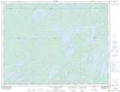
Maps showing Lac Chico, Baie-James; Jamésie, Quebec
Lac Chico is a Lake located in Baie-James; Jamésie, Quebec and has an elevation of 371 meters.
- Latitude: 49° 34' 48'' North (decimal: 49.5800682)
- Longitude: 74° 36' 31'' West (decimal: -74.6084745)
- Topography Feature Category: Lake
- Geographical Feature: Lac
- Canadian Province/Territory: Quebec
- Elevation: 371 meters
- Location: Baie-James; Jamésie
- Atlas of Canada Locator Map: Lac Chico
- GPS Coordinate Locator Map: Lac Chico Lat/Long
Lac Chico NTS Map Sheets