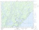
Maps showing Rivière Shipastouk, Baie-James; Jamésie, Quebec
Rivière Shipastouk is a Channel located in Baie-James; Jamésie, Quebec and has an elevation of 367 meters.
- Latitude: 51° 13' 11'' North (decimal: 51.2197222)
- Longitude: 73° 47' 56'' West (decimal: -73.7988889)
- Topography Feature Category: Channel
- Geographical Feature: Chenal
- Canadian Province/Territory: Quebec
- Elevation: 367 meters
- Location: Baie-James; Jamésie
- Atlas of Canada Locator Map: Rivière Shipastouk
- GPS Coordinate Locator Map: Rivière Shipastouk Lat/Long
Rivière Shipastouk NTS Map Sheets