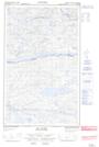
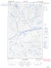
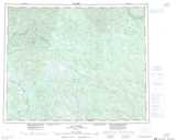
Maps showing Rivière des Cinq Lacs, Lac-Jérôme; Minganie, Quebec
Rivière des Cinq Lacs is a River located in Lac-Jérôme; Minganie, Quebec and has an elevation of 526 meters.
- Latitude: 52° 37' 48'' North (decimal: 52.6300827)
- Longitude: 63° 42' 57'' West (decimal: -63.7159133)
- Topography Feature Category: River
- Geographical Feature: Rivière
- Canadian Province/Territory: Quebec
- Elevation: 526 meters
- Location: Lac-Jérôme; Minganie
- Atlas of Canada Locator Map: Rivière des Cinq Lacs
- GPS Coordinate Locator Map: Rivière des Cinq Lacs Lat/Long
Rivière des Cinq Lacs NTS Map Sheets