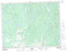
Maps showing Lac Clair, Saint-Stanislas; Maria-Chapdelaine, Quebec
Lac Clair is a Lake located in Saint-Stanislas; Maria-Chapdelaine, Quebec.
- Latitude: 49° 5' 28'' North (decimal: 49.0911111)
- Longitude: 72° 7' 45'' West (decimal: -72.1291667)
- Topography Feature Category: Lake
- Geographical Feature: Lac
- Canadian Province/Territory: Quebec
- Location: Saint-Stanislas; Maria-Chapdelaine
- GPS Coordinate Locator Map: Lac Clair Lat/Long
Lac Clair NTS Map Sheets