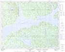
Maps showing Lac Clair, Rivière-aux-Outardes; Manicouagan, Quebec
Lac Clair is a Lake located in Rivière-aux-Outardes; Manicouagan, Quebec.
- Latitude: 51° 32' 23'' North (decimal: 51.5397222)
- Longitude: 68° 47' 22'' West (decimal: -68.7894443)
- Topography Feature Category: Lake
- Geographical Feature: Lac
- Canadian Province/Territory: Quebec
- Location: Rivière-aux-Outardes; Manicouagan
- GPS Coordinate Locator Map: Lac Clair Lat/Long
Lac Clair NTS Map Sheets