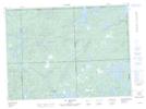
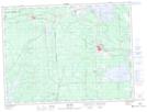
Maps showing Baie du Club, Lac-Granet; Vallée-de-l'Or, Quebec
Baie du Club is a Bay located in Lac-Granet; Vallée-de-l'Or, Quebec and has an elevation of 301 meters.
- Latitude: 48° 0' 5'' North (decimal: 48.0013889)
- Longitude: 78° 7' 17'' West (decimal: -78.1213889)
- Topography Feature Category: Bay
- Geographical Feature: Baie
- Canadian Province/Territory: Quebec
- Elevation: 301 meters
- Location: Lac-Granet; Vallée-de-l'Or
- Atlas of Canada Locator Map: Baie du Club
- GPS Coordinate Locator Map: Baie du Club Lat/Long
Baie du Club NTS Map Sheets