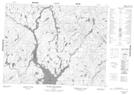
Maps showing Rivière Cocoumenen, Mont-Valin; Le Fjord-du-Saguenay, Quebec
Rivière Cocoumenen is a River located in Mont-Valin; Le Fjord-du-Saguenay, Quebec and has an elevation of 451 meters.
- Latitude: 50° 29' 30'' North (decimal: 50.4917385)
- Longitude: 71° 17' 7'' West (decimal: -71.2853505)
- Topography Feature Category: River
- Geographical Feature: Rivière
- Canadian Province/Territory: Quebec
- Elevation: 451 meters
- Location: Mont-Valin; Le Fjord-du-Saguenay
- Atlas of Canada Locator Map: Rivière Cocoumenen
- GPS Coordinate Locator Map: Rivière Cocoumenen Lat/Long
Rivière Cocoumenen NTS Map Sheets