Canada Topographic Maps

Rivière Conn Topo Maps

Topography maps and Latitude/Longitude Location

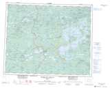
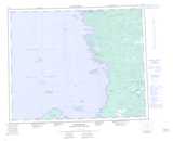
Maps showing Rivière Conn, Baie-James; Jamésie, Quebec

Rivière Conn is a River located in Baie-James; Jamésie, Quebec and has an elevation of 5 meters.

  • Latitude: 52° 21' 39'' North   (decimal: 52.3608333)
  • Longitude: 78° 30' 3'' West   (decimal: -78.5008332)
  • Topography Feature Category: River
  • Geographical Feature: Rivière
  • Canadian Province/Territory: Quebec
  • Elevation: 5 meters
  • Location: Baie-James; Jamésie
  • Atlas of Canada Locator Map: Rivière Conn
  • GPS Coordinate Locator Map: Rivière Conn Lat/Long

Rivière Conn NTS Map Sheets

033C05 Lac Elmer Topographic Map at 1:50,000 scale

033C12 Lac Conn Topographic Map at 1:50,000 scale

033D07 Cape Hope Islands Topographic Map at 1:50,000 scale

033D08 Riviere Conn Topographic Map at 1:50,000 scale

033C Reservoir Opinaca Topographic Map at 1:250,000 scale

033D Eastmain Topographic Map at 1:250,000 scale

 
Buy Topographic Maps DVD
Newsletter Sign-up

Yes, I want to receive map store discounts.


Bookmark and Share