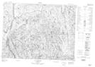
Maps showing Rivière Connelly, Chute-des-Passes; Maria-Chapdelaine, Quebec
Rivière Connelly is a River located in Chute-des-Passes; Maria-Chapdelaine, Quebec.
- Latitude: 49° 22' 25'' North (decimal: 49.3736475)
- Longitude: 71° 56' 54'' West (decimal: -71.9483326)
- Topography Feature Category: River
- Geographical Feature: Rivière
- Canadian Province/Territory: Quebec
- Location: Chute-des-Passes; Maria-Chapdelaine
- Atlas of Canada Locator Map: Rivière Connelly
- GPS Coordinate Locator Map: Rivière Connelly Lat/Long
Rivière Connelly NTS Map Sheets