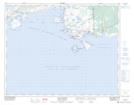
Maps showing Rocher Cow House, Blanc-Sablon; Basse-Côte-Nord, Quebec
Rocher Cow House is a Island located in Blanc-Sablon; Basse-Côte-Nord, Quebec and has an elevation of 0 meters.
- Latitude: 51° 23' 53'' North (decimal: 51.3981075)
- Longitude: 57° 9' 21'' West (decimal: -57.1557285)
- Topography Feature Category: Island
- Geographical Feature: Rocher
- Canadian Province/Territory: Quebec
- Elevation: 0 meters
- Location: Blanc-Sablon; Basse-Côte-Nord
- Atlas of Canada Locator Map: Rocher Cow House
- GPS Coordinate Locator Map: Rocher Cow House Lat/Long
Rocher Cow House NTS Map Sheets