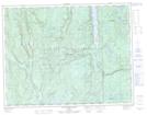
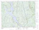
Maps showing Rivière aux Crapauds, Lac-Walker; Sept-Rivières, Quebec
Rivière aux Crapauds is a River located in Lac-Walker; Sept-Rivières, Quebec and has an elevation of 111 meters.
- Latitude: 49° 58' 41'' North (decimal: 49.9781001)
- Longitude: 67° 22' 51'' West (decimal: -67.3807759)
- Topography Feature Category: River
- Geographical Feature: Rivière
- Canadian Province/Territory: Quebec
- Elevation: 111 meters
- Location: Lac-Walker; Sept-Rivières
- Atlas of Canada Locator Map: Rivière aux Crapauds
- GPS Coordinate Locator Map: Rivière aux Crapauds Lat/Long
Rivière aux Crapauds NTS Map Sheets