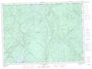
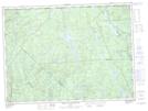
Maps showing Petite rivière Croche, La Tuque; Le Haut-Saint-Maurice, Quebec
Petite rivière Croche is a River located in La Tuque; Le Haut-Saint-Maurice, Quebec and has an elevation of 195 meters.
- Latitude: 47° 53' 15'' North (decimal: 47.8875443)
- Longitude: 72° 40' 54'' West (decimal: -72.6817826)
- Topography Feature Category: River
- Geographical Feature: Rivière
- Canadian Province/Territory: Quebec
- Elevation: 195 meters
- Location: La Tuque; Le Haut-Saint-Maurice
- Atlas of Canada Locator Map: Petite rivière Croche
- GPS Coordinate Locator Map: Petite rivière Croche Lat/Long
Petite rivière Croche NTS Map Sheets