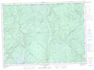
Maps showing Rapides Croches, La Tuque; Le Haut-Saint-Maurice, Quebec
Rapides Croches is a Rapids located in La Tuque; Le Haut-Saint-Maurice, Quebec.
- Latitude: 47° 56' 58'' North (decimal: 47.9494895)
- Longitude: 72° 43' 42'' West (decimal: -72.7284507)
- Topography Feature Category: Rapids
- Geographical Feature: Rapides
- Canadian Province/Territory: Quebec
- Location: La Tuque; Le Haut-Saint-Maurice
- Atlas of Canada Locator Map: Rapides Croches
- GPS Coordinate Locator Map: Rapides Croches Lat/Long
Rapides Croches NTS Map Sheets