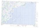
Maps showing Rivière à la Croix, Côte-Nord-du-Golfe-du-Saint-Laurent; Basse-Côte-Nord, Quebec
Rivière à la Croix is a River located in Côte-Nord-du-Golfe-du-Saint-Laurent; Basse-Côte-Nord, Quebec and has an elevation of 20 meters.
- Latitude: 50° 27' 34'' North (decimal: 50.4595032)
- Longitude: 59° 39' 14'' West (decimal: -59.6538872)
- Topography Feature Category: River
- Geographical Feature: Rivière
- Canadian Province/Territory: Quebec
- Elevation: 20 meters
- Location: Côte-Nord-du-Golfe-du-Saint-Laurent; Basse-Côte-Nord
- Atlas of Canada Locator Map: Rivière à la Croix
- GPS Coordinate Locator Map: Rivière à la Croix Lat/Long
Rivière à la Croix NTS Map Sheets