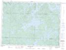
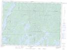
Maps showing Ruisseau Cullen, Réservoir-Dozois; Vallée-de-l'Or, Quebec
Ruisseau Cullen is a River located in Réservoir-Dozois; Vallée-de-l'Or, Quebec and has an elevation of 359 meters.
- Latitude: 47° 30' 11'' North (decimal: 47.5030556)
- Longitude: 77° 17' 15'' West (decimal: -77.2875)
- Topography Feature Category: River
- Geographical Feature: Ruisseau
- Canadian Province/Territory: Quebec
- Elevation: 359 meters
- Location: Réservoir-Dozois; Vallée-de-l'Or
- Atlas of Canada Locator Map: Ruisseau Cullen
- GPS Coordinate Locator Map: Ruisseau Cullen Lat/Long
Ruisseau Cullen NTS Map Sheets