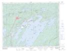
Maps showing Rivière Cummings, Chibougamau; Jamésie, Quebec
Rivière Cummings is a River located in Chibougamau; Jamésie, Quebec.
- Latitude: 49° 59' 59'' North (decimal: 49.9997222)
- Longitude: 74° 10' 52'' West (decimal: -74.1811110)
- Topography Feature Category: River
- Geographical Feature: Rivière
- Canadian Province/Territory: Quebec
- Location: Chibougamau; Jamésie
- GPS Coordinate Locator Map: Rivière Cummings Lat/Long
Rivière Cummings NTS Map Sheets