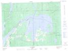
Maps showing Baie Dallaire, Moffet; Témiscamingue, Quebec
Baie Dallaire is a Bay located in Moffet; Témiscamingue, Quebec and has an elevation of 246 meters.
- Latitude: 47° 39' 49'' North (decimal: 47.6636111)
- Longitude: 78° 47' 54'' West (decimal: -78.7983333)
- Topography Feature Category: Bay
- Geographical Feature: Baie
- Canadian Province/Territory: Quebec
- Elevation: 246 meters
- Location: Moffet; Témiscamingue
- Atlas of Canada Locator Map: Baie Dallaire
- GPS Coordinate Locator Map: Baie Dallaire Lat/Long
Baie Dallaire NTS Map Sheets