Maps showing Lac Dambourney, Chute-des-Passes; Maria-Chapdelaine, Quebec
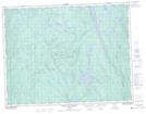
Lac Dambourney is a Lake located in Chute-des-Passes; Maria-Chapdelaine, Quebec and has an elevation of 477 meters.
- Latitude: 49° 53' 27'' North (decimal: 49.8908333)
- Longitude: 72° 2' 31'' West (decimal: -72.0419444)
- Topography Feature Category: Lake
- Geographical Feature: Lac
- Canadian Province/Territory: Quebec
- Elevation: 477 meters
- Location: Chute-des-Passes; Maria-Chapdelaine
- Atlas of Canada Locator Map: Lac Dambourney
- GPS Coordinate Locator Map: Lac Dambourney Lat/Long
Lac Dambourney NTS Map Sheets