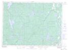
Maps showing Ruisseau Dan, Cayamant; La Vallée-de-la-Gatineau, Quebec
Ruisseau Dan is a River located in Cayamant; La Vallée-de-la-Gatineau, Quebec and has an elevation of 200 meters.
- Latitude: 46° 14' 4'' North (decimal: 46.2345010)
- Longitude: 76° 18' 40'' West (decimal: -76.3110684)
- Topography Feature Category: River
- Geographical Feature: Ruisseau
- Canadian Province/Territory: Quebec
- Elevation: 200 meters
- Location: Cayamant; La Vallée-de-la-Gatineau
- Atlas of Canada Locator Map: Ruisseau Dan
- GPS Coordinate Locator Map: Ruisseau Dan Lat/Long
Ruisseau Dan NTS Map Sheets