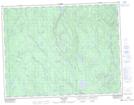
Maps showing Rivière Déception, Rivière-Mistassini; Maria-Chapdelaine, Quebec
Rivière Déception is a River located in Rivière-Mistassini; Maria-Chapdelaine, Quebec and has an elevation of 413 meters.
- Latitude: 49° 40' 23'' North (decimal: 49.6731170)
- Longitude: 72° 17' 11'' West (decimal: -72.2864727)
- Topography Feature Category: River
- Geographical Feature: Rivière
- Canadian Province/Territory: Quebec
- Elevation: 413 meters
- Location: Rivière-Mistassini; Maria-Chapdelaine
- Atlas of Canada Locator Map: Rivière Déception
- GPS Coordinate Locator Map: Rivière Déception Lat/Long
Rivière Déception NTS Map Sheets