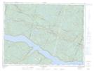
Maps showing Lac Dernier, Rivière-Éternité; Le Fjord-du-Saguenay, Quebec
Lac Dernier is a Lake located in Rivière-Éternité; Le Fjord-du-Saguenay, Quebec and has an elevation of 323 meters.
- Latitude: 48° 19' 40'' North (decimal: 48.3278068)
- Longitude: 70° 24' 8'' West (decimal: -70.4022898)
- Topography Feature Category: Lake
- Geographical Feature: Lac
- Canadian Province/Territory: Quebec
- Elevation: 323 meters
- Location: Rivière-Éternité; Le Fjord-du-Saguenay
- Atlas of Canada Locator Map: Lac Dernier
- GPS Coordinate Locator Map: Lac Dernier Lat/Long
Lac Dernier NTS Map Sheets