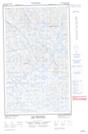
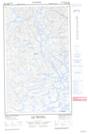
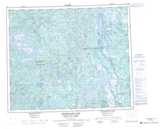
Maps showing Lac Descayrac, Caniapiscau; Caniapiscau, Quebec
Lac Descayrac is a Lake located in Caniapiscau; Caniapiscau, Quebec and has an elevation of 603 meters.
- Latitude: 53° 53' 38'' North (decimal: 53.8938889)
- Longitude: 67° 44' 48'' West (decimal: -67.7466667)
- Topography Feature Category: Lake
- Geographical Feature: Lac
- Canadian Province/Territory: Quebec
- Elevation: 603 meters
- Location: Caniapiscau; Caniapiscau
- Atlas of Canada Locator Map: Lac Descayrac
- GPS Coordinate Locator Map: Lac Descayrac Lat/Long
Lac Descayrac NTS Map Sheets