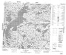
Maps showing Lac Desclaux, Rivière-Koksoak; Kativik, Quebec
Lac Desclaux is a Lake located in Rivière-Koksoak; Kativik, Quebec.
- Latitude: 59° 38' 1'' North (decimal: 59.6335585)
- Longitude: 71° 33' 19'' West (decimal: -71.5551642)
- Topography Feature Category: Lake
- Geographical Feature: Lac
- Canadian Province/Territory: Quebec
- Location: Rivière-Koksoak; Kativik
- Atlas of Canada Locator Map: Lac Desclaux
- GPS Coordinate Locator Map: Lac Desclaux Lat/Long
Lac Desclaux NTS Map Sheets