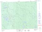
Maps showing Lac Des Nogeau, Baie-James; Jamésie, Quebec
Lac Des Nogeau is a Lake located in Baie-James; Jamésie, Quebec and has an elevation of 133 meters.
- Latitude: 50° 35' 27'' North (decimal: 50.5908333)
- Longitude: 78° 55' 45'' West (decimal: -78.9291666)
- Topography Feature Category: Lake
- Geographical Feature: Lac
- Canadian Province/Territory: Quebec
- Elevation: 133 meters
- Location: Baie-James; Jamésie
- Atlas of Canada Locator Map: Lac Des Nogeau
- GPS Coordinate Locator Map: Lac Des Nogeau Lat/Long
Lac Des Nogeau NTS Map Sheets