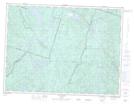
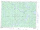
Maps showing Lac des Deux Clubs, Lac-Bouchette; Le Domaine-du-Roy, Quebec
Lac des Deux Clubs is a Lake located in Lac-Bouchette; Le Domaine-du-Roy, Quebec and has an elevation of 423 meters.
- Latitude: 48° 7' 36'' North (decimal: 48.1267116)
- Longitude: 71° 57' 56'' West (decimal: -71.9656654)
- Topography Feature Category: Lake
- Geographical Feature: Lac
- Canadian Province/Territory: Quebec
- Elevation: 423 meters
- Location: Lac-Bouchette; Le Domaine-du-Roy
- Atlas of Canada Locator Map: Lac des Deux Clubs
- GPS Coordinate Locator Map: Lac des Deux Clubs Lat/Long
Lac des Deux Clubs NTS Map Sheets