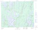
Maps showing Lac Diéreville, Mistissini; Jamésie, Quebec
Lac Diéreville is a Lake located in Mistissini; Jamésie, Quebec and has an elevation of 416 meters.
- Latitude: 50° 19' 23'' North (decimal: 50.3230556)
- Longitude: 73° 57' 48'' West (decimal: -73.9633333)
- Topography Feature Category: Lake
- Geographical Feature: Lac
- Canadian Province/Territory: Quebec
- Elevation: 416 meters
- Location: Mistissini; Jamésie
- Atlas of Canada Locator Map: Lac Diéreville
- GPS Coordinate Locator Map: Lac Diéreville Lat/Long
Lac Diéreville NTS Map Sheets