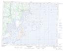
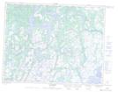
Maps showing Île du Dimanche, Petit-Mécatina; Minganie, Quebec
Île du Dimanche is a Island located in Petit-Mécatina; Minganie, Quebec and has an elevation of 26 meters.
- Latitude: 50° 40' 1'' North (decimal: 50.6670036)
- Longitude: 59° 30' 2'' West (decimal: -59.5005410)
- Topography Feature Category: Island
- Geographical Feature: Île / Ile
- Canadian Province/Territory: Quebec
- Elevation: 26 meters
- Location: Petit-Mécatina; Minganie
- Atlas of Canada Locator Map: Île du Dimanche
- GPS Coordinate Locator Map: Île du Dimanche Lat/Long
Île du Dimanche NTS Map Sheets