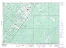
Maps showing Dionne, Saint-Omer; L'Islet, Quebec
Dionne is a Geographical area located in Saint-Omer; L'Islet, Quebec.
- Latitude: 47° 2' North (decimal: 47.0333333)
- Longitude: 69° 44' West (decimal: -69.7333333)
- Topography Feature Category: Geographical area
- Geographical Feature: Canton
- Canadian Province/Territory: Quebec
- Location: Saint-Omer; L'Islet
- Atlas of Canada Locator Map: Dionne
- GPS Coordinate Locator Map: Dionne Lat/Long
Dionne NTS Map Sheets


021K Map Not Available Topographic Map at 1:250,000 scale
