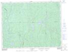
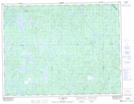
Maps showing Rivière Dobleau, Lac-Ashuapmushuan; Le Domaine-du-Roy, Quebec
Rivière Dobleau is a River located in Lac-Ashuapmushuan; Le Domaine-du-Roy, Quebec and has an elevation of 419 meters.
- Latitude: 49° 38' 35'' North (decimal: 49.6431197)
- Longitude: 73° 28' 51'' West (decimal: -73.4809565)
- Topography Feature Category: River
- Geographical Feature: Rivière
- Canadian Province/Territory: Quebec
- Elevation: 419 meters
- Location: Lac-Ashuapmushuan; Le Domaine-du-Roy
- Atlas of Canada Locator Map: Rivière Dobleau
- GPS Coordinate Locator Map: Rivière Dobleau Lat/Long
Rivière Dobleau NTS Map Sheets