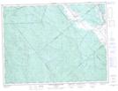
Maps showing Rivière au Doré Ouest, La Doré; Le Domaine-du-Roy, Quebec
Rivière au Doré Ouest is a River located in La Doré; Le Domaine-du-Roy, Quebec and has an elevation of 306 meters.
- Latitude: 48° 42' 56'' North (decimal: 48.7155858)
- Longitude: 72° 37' 26'' West (decimal: -72.6239619)
- Topography Feature Category: River
- Geographical Feature: Rivière
- Canadian Province/Territory: Quebec
- Elevation: 306 meters
- Location: La Doré; Le Domaine-du-Roy
- Atlas of Canada Locator Map: Rivière au Doré Ouest
- GPS Coordinate Locator Map: Rivière au Doré Ouest Lat/Long
Rivière au Doré Ouest NTS Map Sheets