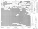
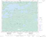
Maps showing Collines Doureau, Baie-James; Jamésie, Quebec
Collines Doureau is a Mountain located in Baie-James; Jamésie, Quebec and has an elevation of 322 meters.
- Latitude: 53° 46' 18'' North (decimal: 53.7716667)
- Longitude: 75° 11' 55'' West (decimal: -75.1986111)
- Topography Feature Category: Mountain
- Geographical Feature: Collines
- Canadian Province/Territory: Quebec
- Elevation: 322 meters
- Location: Baie-James; Jamésie
- Atlas of Canada Locator Map: Collines Doureau
- GPS Coordinate Locator Map: Collines Doureau Lat/Long
Collines Doureau NTS Map Sheets