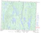
Maps showing Lac-Dufresne, Rivière-Nipissis; Sept-Rivières, Quebec
Lac-Dufresne is a Unincorporated area located in Rivière-Nipissis; Sept-Rivières, Quebec and has an elevation of 610 meters.
- Latitude: 51° 41' 49'' North (decimal: 51.6969985)
- Longitude: 65° 41' 18'' West (decimal: -65.6882412)
- Topography Feature Category: Unincorporated area
- Geographical Feature: Arrêt ferroviaire
- Canadian Province/Territory: Quebec
- Elevation: 610 meters
- Location: Rivière-Nipissis; Sept-Rivières
- Atlas of Canada Locator Map: Lac-Dufresne
- GPS Coordinate Locator Map: Lac-Dufresne Lat/Long
Lac-Dufresne NTS Map Sheets