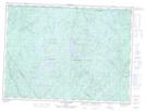
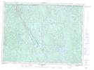
Maps showing Lac Dullin, Lac-Jacques-Cartier; La Côte-de-Beaupré, Quebec
Lac Dullin is a Lake located in Lac-Jacques-Cartier; La Côte-de-Beaupré, Quebec and has an elevation of 789 meters.
- Latitude: 47° 49' 56'' North (decimal: 47.8322222)
- Longitude: 71° 29' 56'' West (decimal: -71.4988889)
- Topography Feature Category: Lake
- Geographical Feature: Lac
- Canadian Province/Territory: Quebec
- Elevation: 789 meters
- Location: Lac-Jacques-Cartier; La Côte-de-Beaupré
- Atlas of Canada Locator Map: Lac Dullin
- GPS Coordinate Locator Map: Lac Dullin Lat/Long
Lac Dullin NTS Map Sheets