Canada Topographic Maps

Rivière Dumoine Topo Maps

Topography maps and Latitude/Longitude Location

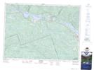
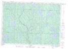
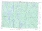
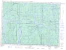
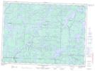
Maps showing Rivière Dumoine, Rapides-des-Joachims; Pontiac, Quebec

Rivière Dumoine is a River located in Rapides-des-Joachims; Pontiac, Quebec and has an elevation of 318 meters.

  • Latitude: 46° 13' 0'' North   (decimal: 46.2167280)
  • Longitude: 77° 50' 56'' West   (decimal: -77.8489238)
  • Topography Feature Category: River
  • Geographical Feature: Rivière
  • Canadian Province/Territory: Quebec
  • Elevation: 318 meters
  • Location: Rapides-des-Joachims; Pontiac
  • Atlas of Canada Locator Map: Rivière Dumoine
  • GPS Coordinate Locator Map: Rivière Dumoine Lat/Long

Rivière Dumoine NTS Map Sheets

031K04 Rolphton Topographic Map at 1:50,000 scale

031K05 Lac Du Pinceau Topographic Map at 1:50,000 scale

031K12 Lac Russell Topographic Map at 1:50,000 scale

031K13 Lac Dumoine Topographic Map at 1:50,000 scale

031N04 Lac Antiquois Topographic Map at 1:50,000 scale

031N05 Lac Cawasachouane Topographic Map at 1:50,000 scale

031K Deep River Topographic Map at 1:250,000 scale

031N Grand-Lac-Victoria Topographic Map at 1:250,000 scale

 
Buy Topographic Maps DVD
Newsletter Sign-up

Yes, I want to receive map store discounts.


Bookmark and Share