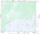
Maps showing Lac Duplanter, Caniapiscau; Caniapiscau, Quebec
Lac Duplanter is a Lake located in Caniapiscau; Caniapiscau, Quebec and has an elevation of 492 meters.
- Latitude: 54° 52' 51'' North (decimal: 54.8808333)
- Longitude: 69° 47' 39'' West (decimal: -69.7941667)
- Topography Feature Category: Lake
- Geographical Feature: Lac
- Canadian Province/Territory: Quebec
- Elevation: 492 meters
- Location: Caniapiscau; Caniapiscau
- Atlas of Canada Locator Map: Lac Duplanter
- GPS Coordinate Locator Map: Lac Duplanter Lat/Long
Lac Duplanter NTS Map Sheets