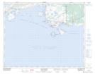
Maps showing Rocher East, Blanc-Sablon; Basse-Côte-Nord, Quebec
Rocher East is a Island located in Blanc-Sablon; Basse-Côte-Nord, Quebec.
- Latitude: 51° 26' 34'' North (decimal: 51.4428304)
- Longitude: 57° 14' 30'' West (decimal: -57.2415644)
- Topography Feature Category: Island
- Geographical Feature: Rocher
- Canadian Province/Territory: Quebec
- Location: Blanc-Sablon; Basse-Côte-Nord
- Atlas of Canada Locator Map: Rocher East
- GPS Coordinate Locator Map: Rocher East Lat/Long
Rocher East NTS Map Sheets