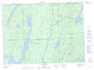
Maps showing Lac à l'Eau Claire, Rouyn-Noranda; Rouyn-Noranda, Quebec
Lac à l'Eau Claire is a Lake located in Rouyn-Noranda; Rouyn-Noranda, Quebec and has an elevation of 291 meters.
- Latitude: 47° 56' 40'' North (decimal: 47.9445258)
- Longitude: 78° 38' 29'' West (decimal: -78.6414643)
- Topography Feature Category: Lake
- Geographical Feature: Lac
- Canadian Province/Territory: Quebec
- Elevation: 291 meters
- Location: Rouyn-Noranda; Rouyn-Noranda
- Atlas of Canada Locator Map: Lac à l'Eau Claire
- GPS Coordinate Locator Map: Lac à l'Eau Claire Lat/Long
Lac à l'Eau Claire NTS Map Sheets