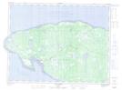
Maps showing English Head, L'Île-d'Anticosti; Minganie, Quebec
English Head is a Cape located in L'Île-d'Anticosti; Minganie, Quebec.
- Latitude: 49° 54' 8'' North (decimal: 49.9022222)
- Longitude: 64° 29' 19'' West (decimal: -64.4886111)
- Topography Feature Category: Cape
- Geographical Feature: Cap
- Canadian Province/Territory: Quebec
- Location: L'Île-d'Anticosti; Minganie
- GPS Coordinate Locator Map: English Head Lat/Long
English Head NTS Map Sheets