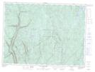
Maps showing Rivière à l'Épaule, Stoneham-et-Tewkesbury; La Jacques-Cartier, Quebec
Rivière à l'Épaule is a River located in Stoneham-et-Tewkesbury; La Jacques-Cartier, Quebec and has an elevation of 644 meters.
- Latitude: 47° 7' 11'' North (decimal: 47.1197424)
- Longitude: 71° 21' 28'' West (decimal: -71.3578747)
- Topography Feature Category: River
- Geographical Feature: Rivière
- Canadian Province/Territory: Quebec
- Elevation: 644 meters
- Location: Stoneham-et-Tewkesbury; La Jacques-Cartier
- Atlas of Canada Locator Map: Rivière à l'Épaule
- GPS Coordinate Locator Map: Rivière à l'Épaule Lat/Long
Rivière à l'Épaule NTS Map Sheets