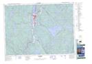
Maps showing Rivière Épervier, La Tuque; Le Haut-Saint-Maurice, Quebec
Rivière Épervier is a River located in La Tuque; Le Haut-Saint-Maurice, Quebec and has an elevation of 295 meters.
- Latitude: 47° 23' 10'' North (decimal: 47.3861443)
- Longitude: 72° 33' 41'' West (decimal: -72.5614931)
- Topography Feature Category: River
- Geographical Feature: Rivière
- Canadian Province/Territory: Quebec
- Elevation: 295 meters
- Location: La Tuque; Le Haut-Saint-Maurice
- Atlas of Canada Locator Map: Rivière Épervier
- GPS Coordinate Locator Map: Rivière Épervier Lat/Long