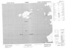
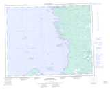
Maps showing Cap d'Espoir, Baie-James; Jamésie, Quebec
Cap d'Espoir is a Cape located in Baie-James; Jamésie, Quebec and has an elevation of 4 meters.
- Latitude: 52° 25' 18'' North (decimal: 52.4216667)
- Longitude: 78° 32' 48'' West (decimal: -78.5466667)
- Topography Feature Category: Cape
- Geographical Feature: Cap
- Canadian Province/Territory: Quebec
- Elevation: 4 meters
- Location: Baie-James; Jamésie
- Atlas of Canada Locator Map: Cap d'Espoir
- GPS Coordinate Locator Map: Cap d'Espoir Lat/Long
Cap d'Espoir NTS Map Sheets