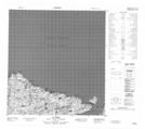
Maps showing Cap De L'Estre, Baie-d'Hudson; Kativik, Quebec
Cap De L'Estre is a Cape located in Baie-d'Hudson; Kativik, Quebec and has an elevation of 15 meters.
- Latitude: 62° 19' 43'' North (decimal: 62.3286413)
- Longitude: 75° 52' 58'' West (decimal: -75.8828485)
- Topography Feature Category: Cape
- Geographical Feature: Cap
- Canadian Province/Territory: Quebec
- Elevation: 15 meters
- Location: Baie-d'Hudson; Kativik
- Atlas of Canada Locator Map: Cap De L'Estre
- GPS Coordinate Locator Map: Cap De L'Estre Lat/Long